Bleaklow: B29 Overexposed Crash Site From Snakes Summit: 4 Mile Circular Route

Moderate
2-3 hours
3.7 miles (6km)
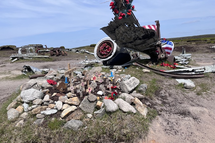
The Bleaklow B-29 crash site circular from Snake Summit is a walk that stays with you long after you’ve finished it. High on the moors above Glossop, the wreckage of the “Over Exposed” — a U.S. Air Force Superfortress that crashed here in 1948 — lies scattered across the peat and heather. All 13 crew members on board lost their lives on that day so please be respectful and do not remove any of the debris from the site.
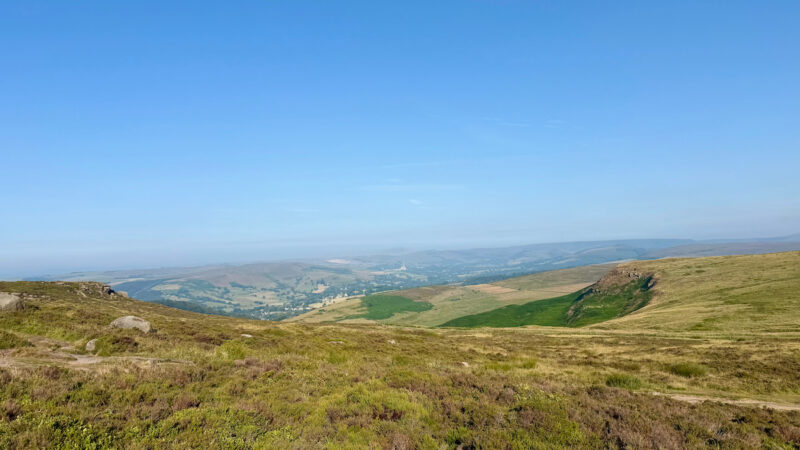
The route begins from the Snake Pass summit and crosses Bleaklow’s wild, open expanse — a landscape that can feel desolate, beautiful, and humbling all at once. Finding the site takes some navigation, but standing among the wreckage and reading the memorial plaque is a quietly moving experience. It’s not just a hike; it’s a walk through history.
Parking on the side of the road along Snake Pass close to the bus stop we completed this walk in winter which added to the dangers of the walk. If you are completing it in similar conditions please take extra care and ensure you are properly prepared.

🌤️ Know Before You Go 🌤️
- Car Park: Snake Pass Summit A57
- What3Words: ///gathering.reap.slacker
- Public Transport: No
- Elevation Gain: 154m
- Terrain: Moorland, boggy, muddy, rocky with some steep sections
- Public Toilets: No
- Family/Dog Friendly: Yes but care should be taken as there are exposed edges
- Scramble Grade: No scrambling
- Worth Noting: The crash site is a memorial to the crew who lost their lives please be respectful
- Met Office Mountain Forecasts
- Mountain Weather Information Service (MWIS)
🥾 Essential Kit 🥾
- Good quality, well fitting walking boots/shoes
- 20-30L rucksack
- Gloves, hat, neck gaitor/snood
- Map, compass, and head torch (spare batteries)
- Emergency First Aid Kit (foil blanket, whistle, plasters)
- Additional layers of clothing
- Waterproof jacket and trousers
- At least 2 litres of water
- Hiking poles (optional)
❄️ Additional Winter Kit ❄️
- Hiking poles with ice fittings
- Waterproof hat and gloves
- Crampons/Ice Axe
- Dry bags
- Extra food and water
- Sun protection
- Emergency shelter such as a survival or bivi bag
- A more comprehensive First Aid Kit
Bleaklow B29 Overexposed crash site route description

Stage 1 – Snakes Summit
Parking up along Snake Road, you need to be careful when entering or exiting your vehicle as this is a very busy road. It is also worth being aware of your surroundings when parking up as some sections even here could be difficult to get out of in bad weather conditions. From Snake Road follow the path along the Pennine Way, through the gate, then a short distance later footpaths meet, here you take a left and leave the Pennine Way.
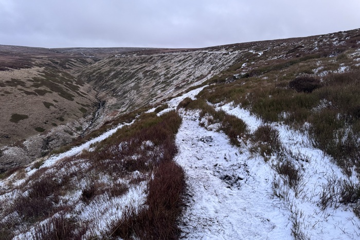
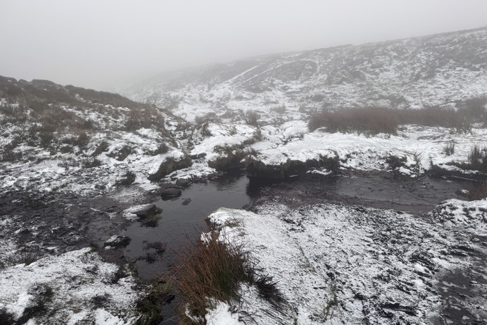
You will reach a Cairn and at this point follow the path to the right, and follow the narrow path along the edge of the valley (Crooked Clough). As you reach the ford you will need to cross over and continue ahead. Be careful here as the terrain becomes very boggy. When we did this route we had wellies on and the below photo demonstrates just how careful you need to be.
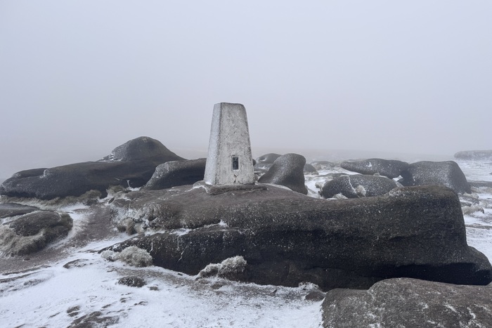
Stage 2 – High Shelf Stones Trig Point & Crash Site

As with most Peak District walks the paths are not always very clear, however, following the OS map is a big help, especially during this section. As you continue uphill the path winds round and High Shelf Stones Trig Point should now come into view. On a clear day the views from here across to Manchester can be stunning. To reach the crash site from here, simply continue ahead and follow the footpath round towards the right, the wreckage will soon come into sight.
As mentioned above it is important to be respectful and if you are walking with kids do not allow them to play on the wreckage and please leave any debris where it is.
Stage 3 – Back on the Pennine Way
From the crash site follow the obvious path down towards the left, again parts of this section are very boggy and you will need to cross a couple of streams and will eventually meet the Pennine Way again. There are waymarked concrete and wooden pillars and usually plenty of people knocking about here. Shortly you will reach the flagstone path which you just follow back towards Snake Road where you parked up.

Got the OS Map App? Follow the route by clicking the link below.
Where to eat and drink after hiking B29 Overexposed crash site from Snakes Summit
Glossop is your best bet for food and drink after hiking the Bleaklow B29 Overexposed crash site. A five-minute drive will bring you onto the Glossop High Street where there are plenty of pubs and restaurants.
As you come down from the Snake Pass and head towards the main high street there is The Commerical Inn on the right hand side. A traditional pub serving a large range of cask ale, wine and spirits in a comfortable lounge setting with a log fire — perfect for those winter walks. Muddy boots and muddy paws are all welcome and they also serve freshly prepared food in a separate dining space.
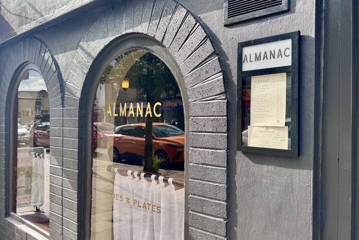
There is a Wetherspoons (The Smithy Fold) if you are after a quick pint and bite to eat. If you are looking for something more substantial there are a number of good places such as The Two Hares, The Victoria Lounge or Almanac further down the highstreet.
Almanac Restaurant & Wine Bar sees chef Luke Payne (of the Michelin-listed, Top 50 Gastropub The Pack Horse in nearby Hayfield) cooking up a delicious range of traditional British sharing plates with a Louisiana twist. Think oysters, mince on dripping toast, fresh fish with buttery curry sauce, and an impossibly light and outrageously wobbly custard tart, with prices around £10 — £28 per dish. The wine and cocktail list are top-notch, and there’s also a vintage absinthe fountain at the bar.
⚠️ A Note of Caution – Bleaklow B-29 Crash Site (via Snake Pass)
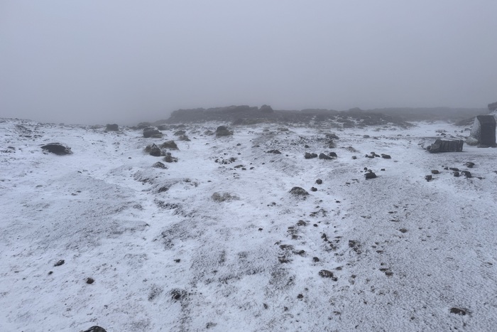
The hike out to the B-29 crash site is across open moorland, which can be very exposed, boggy, and difficult to navigate in poor weather. Mist and strong winds are common, and people have become lost here before — so take a map, compass, and know how to use them.
At the crash site itself, please treat it with respect. The wreckage is a memorial to those who lost their lives. Do not remove or disturb any debris — it’s both unsafe and deeply disrespectful.
It’s a fascinating and moving place to visit, but come prepared, take care, and leave it as you found it.
Pics from the peaks: more from Bleaklow B29 Overexposed