Cock Hill From Old Glossop: 6 Mile Circular

Easy
3-4 hours
6 miles (10km)
The hike up Cock Hill from Old Glossop is one of those quiet Peak District walks that often flies under the radar — but that’s exactly what makes it special. Starting from the cobbled lanes of Old Glossop, the route climbs gently onto open moorland, where the wind feels sharper, the air cleaner, and the world suddenly much bigger.
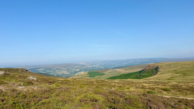
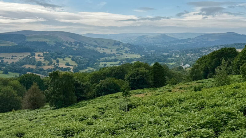
It’s a walk of subtle beauty rather than drama: peat tracks winding between heather and gritstone, distant views over Bleaklow and Kinder Scout, and that peaceful feeling of being miles from anywhere. Cock Hill might not be the highest or hardest summit around, but it’s a reminder that sometimes the best days out are the simple ones — just you, the path, and the moor.
This walk is right on our doorstep so we walk to the start, however, there is free parking available in Old Glossop. There is a small car park opposite The Wheatsheaf pub which is where the walk starts and there is limited on-road parking too (this is a small residential area so please be mindful of residents when parking).

🌤️ Know Before You Go 🌤️
- Car Park: Small car park opposite The Wheatsheaf pub (SK13 7RN)
- What3Words: ///ideal.spindles.february
- Public Transport: Yes. Glossop train station is a 10-minute walk from Old Glossop
- Elevation Gain: 539m
- Terrain: Mainly moorland, boggy, rocky uneven and slippery
- Public Toilets: Yes – located in Manor Park at the Pavilion Cafe usually open 8am-6pm
- Family/Dog Friendly: Yes – dogs should be kept under control as you are crossing farmland
- Scramble Grade: No scrambling
- Worth Noting: You may have to follow open access land at points on this walk if the local farmer has shut off the footpath for any reason, so be sure to have a map.
- Met Office Mountain Forecasts
- Mountain Weather Information Service (MWIS)
🥾 Essential Kit 🥾
- Good quality, well fitting walking boots/shoes
- 20-30L rucksack
- Gloves, hat, neck gaitor/snood
- Map, compass, and head torch (spare batteries)
- Emergency First Aid Kit (foil blanket, whistle, plasters)
- Additional layers of clothing
- Waterproof jacket and trousers
- At least 2 litres of water
- Hiking poles (optional)
❄️ Additional Winter Kit ❄️
- Hiking poles with ice fittings
- Waterproof hat and gloves
- Crampons/Ice Axe
- Dry bags
- Extra food and water
- Sun protection
- Emergency shelter such as a survival or bivi bag
- A more comprehensive First Aid Kit
Cock Hill Circular route description

Stage 1 – Old Glossop to Cock Hill
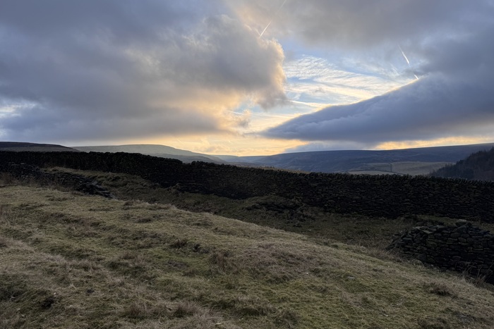
Parking in the car park opposite the Wheatsheaf Pub we headed up Hope Street, keeping the Distant Hills Brewery on your left. A little further up the road splits, take the path to the left where the road sign is to a wooden gate. Climbing up gradually along the footpaths (with it being an old quarry the slabs can be slippery following bad weather so be careful).
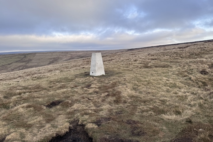
Head through a gate and continue up towards Cock Hill, you can cross back and forth here as the fields can sometimes be easier to than the rocky path. At the next gate (when we did this walk the gate was badly damaged and propped up) head through the gate and up towards Cock Hill Trig Point.
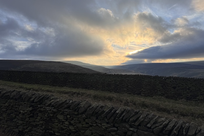
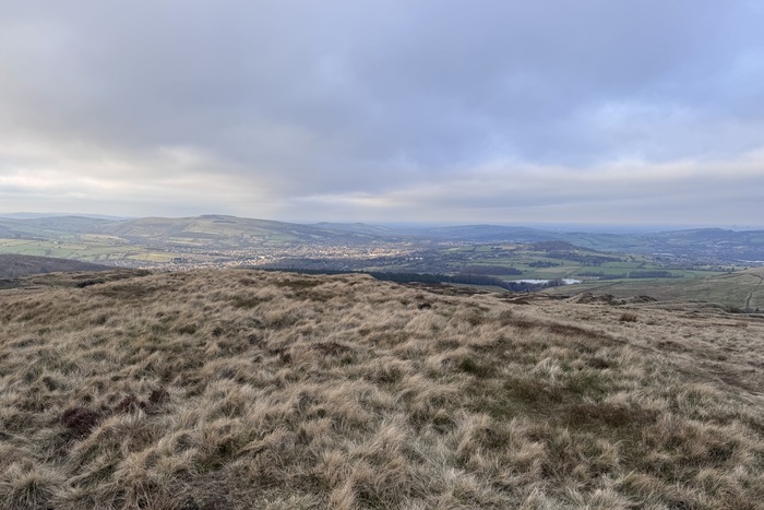
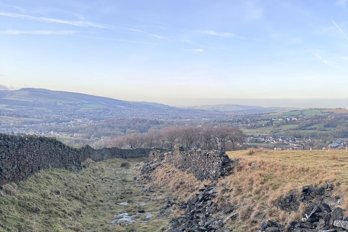
On a good day the views from here at fantastic looking out over Bleaklow and Dogs Rock as well as views towards Manchester.
Stage 2 – Cock Hill Trig to Swineshaw Reservoir

Continuing on from the trig point we ventured further to an old quarry ruin – where we had a quick drink and a snack. Turning back from the quarry the path leads down to the right. Follow the track down a short distance and it brings you to a gate. At the time we visited the farmer had closed the track off so we continued on the open access land. Keeping the wall to our left we headed down through the fields – we did veer slightly off course along the route down towards the farm house – so always good to check the OS Map.
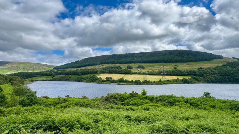
Stage 3 – Swineshaw Reservoir
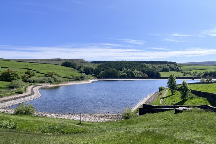
Walking along Swineshaw Reservoir and down the path there is a farm house where you are likely to run into some peacocks roaming about (including albino peacocks). They also have reas (these look like emus) in the field who quite often come up to the wall. The path continues down for a short distance back to the road and the car park opposite The Wheatsheaf Pub.

Got the OS Map App? Follow the route by clicking the link below.
Where to eat and drink after hiking Cock Hill
The Wheatsheaf pub at the time of our visit had recently re-opened under new management following a lengthy closure. A great place to visit for a drink and something to eat which welcomes muddy boots and muddy paws. There are several other places in Old Glossop that are all worth a visit. Distant Hills Brewing (which you passed at the start of the walk) is a well worth visiting, The Bulls Head which is next to The Wheatsheaf or you have The Queens Arms opposite Manor Park.
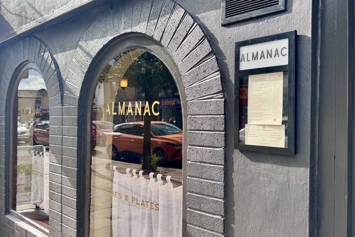
For a fine dining experience you could head back over to Glossop and visit Almanac located on the high street. Almanac Restaurant & Wine Bar sees chef Luke Payne (of the Michelin-listed, Top 50 Gastropub The Pack Horse in nearby Hayfield) cooking up a delicious range of traditional British sharing plates with a Louisiana twist. Think oysters, mince on dripping toast, fresh fish with buttery curry sauce, and an impossibly light and outrageously wobbly custard tart, with prices around £10 — £28 per dish. The wine and cocktail list are top-notch, and there’s also a vintage absinthe fountain at the bar.
⚠️ Warnings & Tips for Hiking Cock Hill from Old Glossop
Navigation: The moorland around Cock Hill can be featureless and confusing in poor visibility. Paths are often faint or boggy, so a map, compass, or GPS is essential — especially if you’re heading further onto Bleaklow or in misty conditions.
Weather: The area is very exposed with little shelter. Conditions can change quickly, so pack layers, waterproofs, and be prepared for wind and rain even on fair-weather days.
Terrain: Expect boggy sections, particularly after rain. Good boots (and gaiters if you have them) make a big difference.
Phone signal: Coverage can be patchy on the upper moors, so don’t rely on your phone for navigation or safety.
Pics from the peaks: more from Cock Hill