Ben Nevis Mountain Track: 10 Mile There And Back Route
Moderate-Difficult
7-9 hours
10.5 miles (17km)
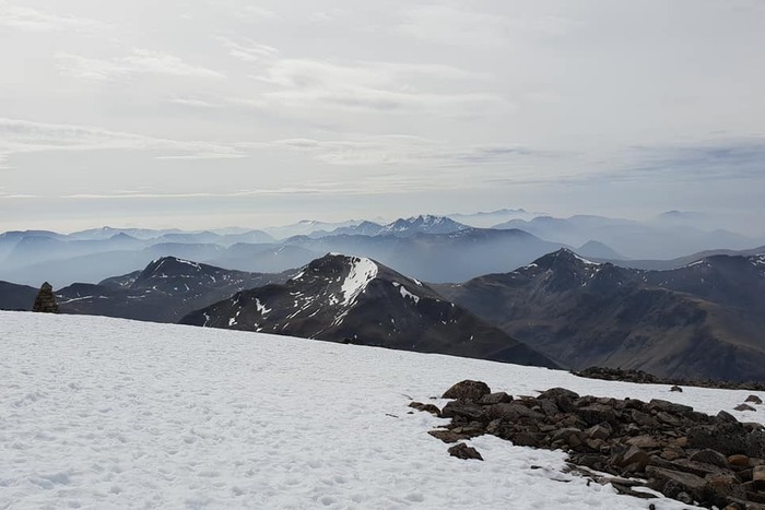
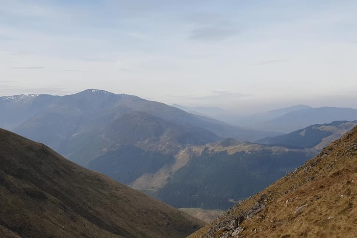
Hiking Ben Nevis via the Mountain Track (also known as The Tourist or Pony Track) is the best route up the UK’s highest mountain for beginner hikers. A steady, rewarding climb to 1,332 metres (4,370 feet). Starting from Glen Nevis, the path begins gently, climbing via a good clear path before zig zagging steadily up the mountain’s broad western flank. As you climb, the views stretch over Fort William, Loch Linnhe, and the surrounding peaks, growing ever more dramatic with height. Be warned the zig zag section of the walk can feel like it is never ending, especially in bad weather but you just have to keep pushing on. On my numerous descents many people have stopped me on this section to ask if they are nearly there yet.
Despite its nickname as the “Tourist Path,” this is a serious mountain route that demands respect. Weather on the summit can change in minutes, and even in summer, it’s not unusual to find cloud, strong winds, or patches of snow. The route is suitable for fit walkers with good stamina; proper footwear, warm clothing, and good navigation skills.
Older children with hiking experience can enjoy the challenge, but it’s not ideal for young kids due to the length and exposure near the summit. Dogs can manage the route if they’re fit and used to rough terrain, but bring plenty of water, avoid hot days, and be mindful of rocky or scree-covered sections. The ideal time to hike this route is late May to early September, when snow has cleared from the upper slopes and daylight hours are longer. Always check the mountain weather forecast before setting off.

🌤️ Know Before You Go 🌤️
- Car Park: Ben Nevis Visitor Centre (PH33 6ST)
- What3Words: ///tables.giraffes.commuting
- Public Transport: Closest train station is Fort Willian with local bus services running to the visitor centre
- Elevation Gain: 1300 metres
- Terrain: Well defined paths, steep, rocky and uneven. Large steps and loose scree. Snow and ice present most of the year (even in summer months)
- Public Toilets: Yes – at the visitor centre (only open when the centre is open between 8am-4pm)
- Family Friendly: Yes – buy not ideal for young kids or pushchairs due to the length and exposure near the summit
- Dog Friendly: Yes – if they are fit and used to rough terrain (bring enough water, especially in summer)
- Munros: (1)
- Scramble Grade: None
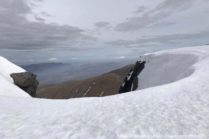
- Other: Beware of the cornices on the summit plateau (on your left) – the snow overhangs here and can collapse
- Met Office Mountain Forecasts
- Mountain Weather Information Service (MWIS)
- Scottish Avalanche Information Service (SAIS)
🥾 Essential Kit 🥾
- Good quality, well fitting walking boots/shoes
- 20-30L rucksack
- Gloves, hat, neck gaitor/snood
- Map, compass, and head torch (spare batteries)
- Emergency First Aid Kit (foil blanket, whistle, plasters)
- Additional layers of clothing
- Waterproof jacket and trousers
- At least 2 litres of water
- Hiking poles (optional)
❄️ Additional Winter Kit ❄️
- Hiking poles with ice fittings
- Waterproof hat and gloves
- Crampons/Ice Axe
- Dry bags
- Extra food and water
- Sun protection
- Emergency shelter such as a survival or bivi bag
- A more comprehensive First Aid Kit
Ben Nevis Mountain Track route description
Stage 1 – Visitor Centre to Red Burn
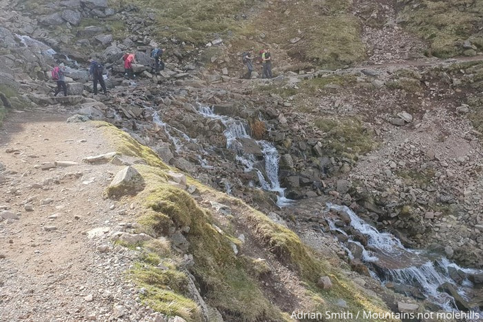
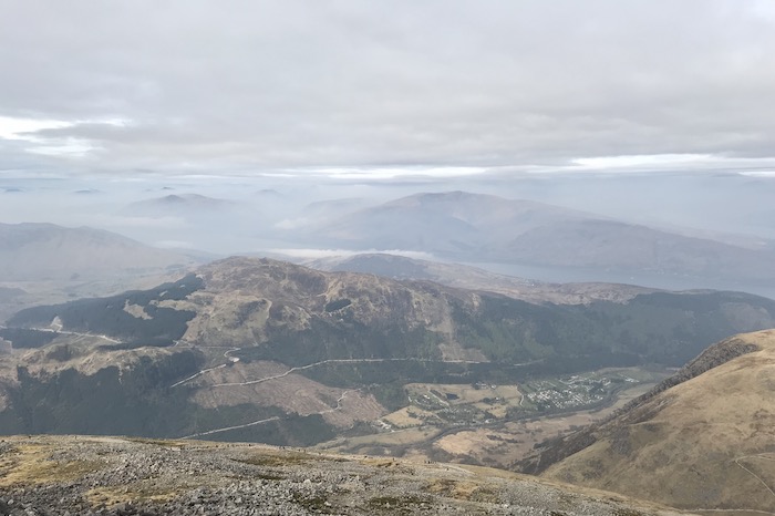
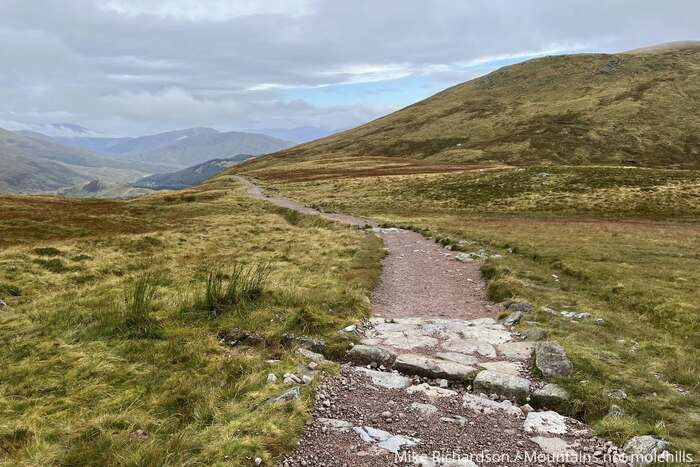
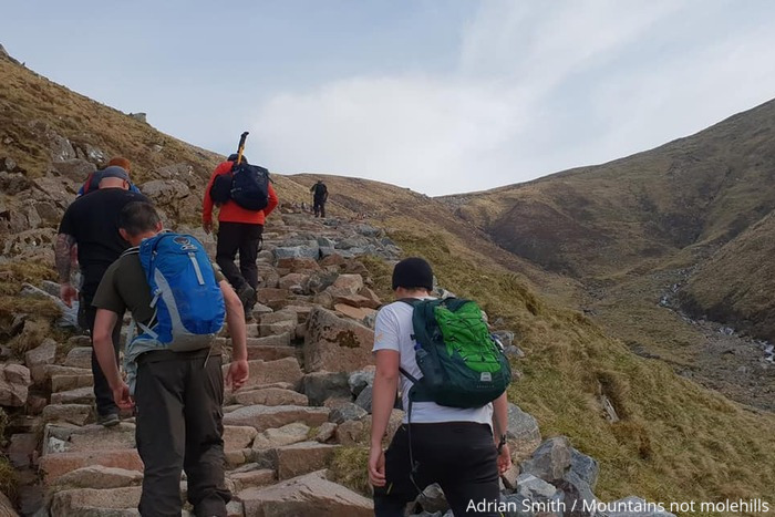
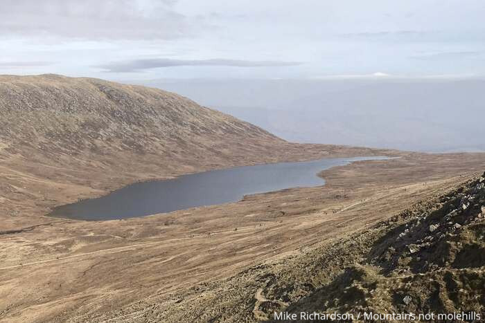
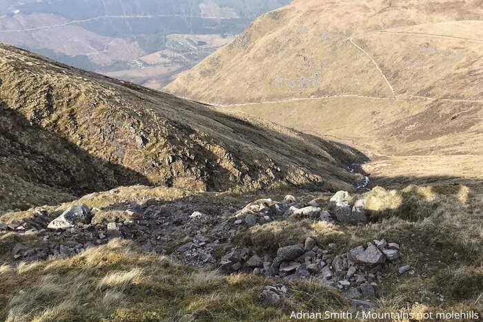
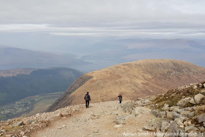
Setting off from the visitors centre the initial stage of this route follows a well constructed path as it climbs towards the halfway lochan or Lochan Meall an t-Suidhe. The beginning of the hike is enjoyable and gets you intro your stride — even early on the views are already pretty spectacular. As you follow the path round to the right and continue onwards the views continue to get evermore impressive. Shortly you will reach Red Burn — a mountain stream forming a small waterfall and shallow crossing. You will find a lot of walkers taking a short break here — mainly for some pictures but also for a brief rest before tackling the steeper zigzags that lead toward the summit plateau.
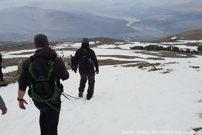
Stage 2 – Red Burn to Ben Nevis Plateau
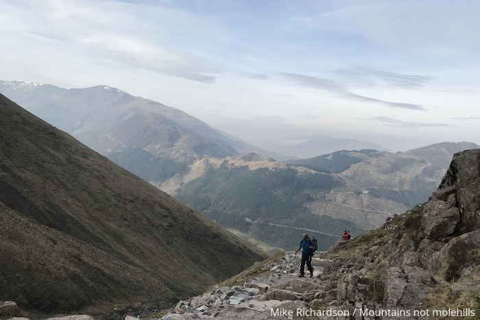
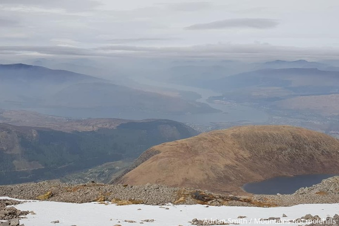
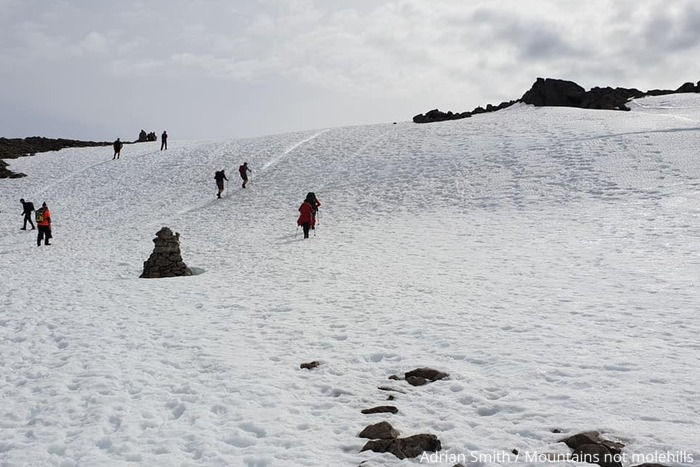
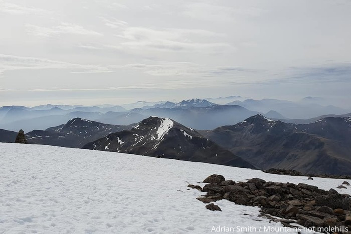
From here the route gets much steeper and the zig zag switch backs feel like they are never going to end as you push on towards Five Finger Gully. In bad weather hikers should be aware of this and be mindful to stay clear of this dangerous area. As you continue the incline does ease slightly until you reach McLean’s Steep where a short steep climb leads you up to the summit plateau. Hitting the summit plateau there is real danger from the North Face to your left — Tower Ridge and Orion Face. Here there are cornices and whilst the views (on a clear day) are breathtaking the cornices can overhang the cliff edge by a good 40 feet. The first time I ever hiked Ben Nevis I was stood looking out before a more experienced hiker warned me to pull back as I was too close to the edge.
Stage 3 – Ben Nevis summit back to the visitor centre
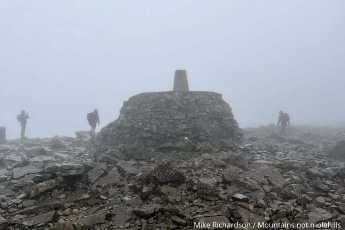
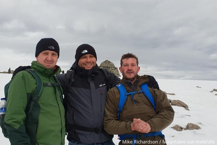
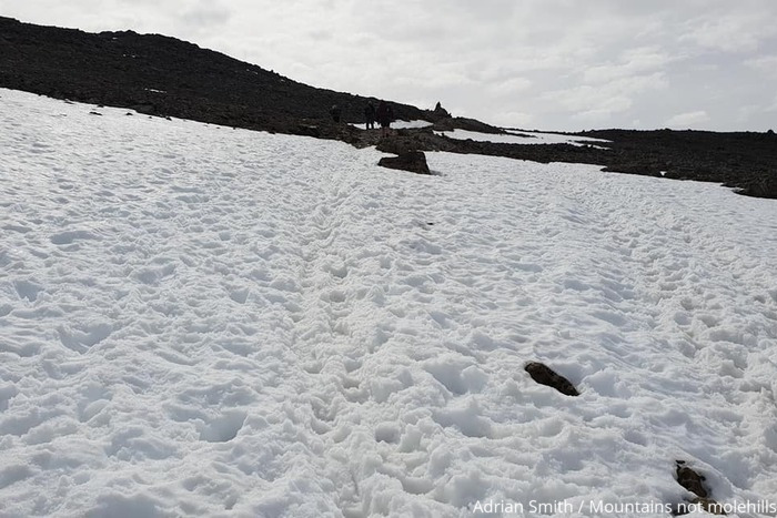
As you make your way onto the summit you will not only see the trig point but also the remains of the observatory and a shelter point. Having hiked Ben Nevis several times these often get fairly buried in heavy snow and you may not be able to see anything but on a clear day the views are truly spectacular. Leaving the summit to return back to the visitors centre needs care as well (especially in poor visibility) as even though a series of cairns offer assistance as with the above these can get buried in snow. It is essential you have good navigation skills to be able to safely navigate your way off the summit and back onto the path. Once back on the path it is a case of retracing your footsteps all the way back down to the visitor centre (often taking a moment to look back) and appreciate what you have just accomplished.
Got the OS Map App? Follow the route by clicking the link below.
Ben Nevis is a challenge, not a stroll — but with good preparation and respect for the mountain, it’s one of the most rewarding climbs in Britain.

🧭 Safety Notes – Ben Nevis via the Mountain Track
Check the forecast: Weather on Ben Nevis changes fast — it can be calm in Glen Nevis and snowing on top. Pack warm, waterproof layers even in summer.
Know your route: In mist, it’s easy to lose the path. Follow the summit cairns on descent — heading straight down leads to dangerous drops above Five Finger Gully.
Watch your footing: The path is long, rocky, and steep, especially on McLean’s Steep. Good boots (and poles) make a big difference.
Respect the distance: It’s a 10.5-mile round trip with 1,345 m of climb — allow 7–9 hours, take plenty of food and water, and pace yourself.
Beware of snow and ice: These can linger well into June and return in autumn. Don’t continue without winter gear and experience.
Dogs and children: Best suited to fit, experienced dogs and older children used to long, demanding walks.
Where to eat and drink after hiking Ben Nevis Mountain Track
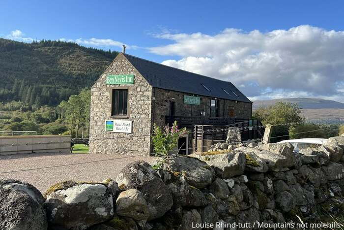
As you complete your walk back down the Mountain Track the Ben Nevis Inn and Bunkhouse is always a welcome sight. The unique 200-year-old converted barn sits right at the foot of Ben Nevis. Eat, drink and stay all whilst enjoying the stunning views of Glen Nevis, in a friendly relaxed atmosphere, with great food and beer. Serving a lunch menu from 12pm-4pm and an evening menu from 5pm-8:30pm (*times subject to change) there is something for everyone. There is also live music every Thursday evening.
*Note: The Ben Nevis Inn are currently undertaking an extension to the restaurant and bar which will open early December 2025. The Inn will be closed for maintenance from 2nd November 2025 and re-open on Thursday 4th December 2025.
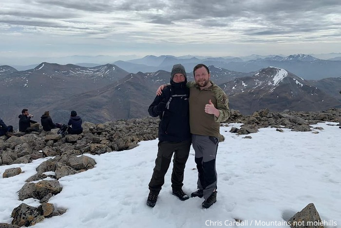
Pics from the peaks: more from Ben Nevis Mountain Track