Steall Falls in Fort William: A short walk to Scotland’s second-highest waterfall
Easy – Moderate
2 Hours
2.5 miles (4km)
Scotland never disappoints me when it comes to walks. In the past I’ve always wanted the big mountain or Munro type walks such as the Ben Nevis mountain track. More recently, however, I have looked for shorter routes for when I didn’t have time for the big ones.
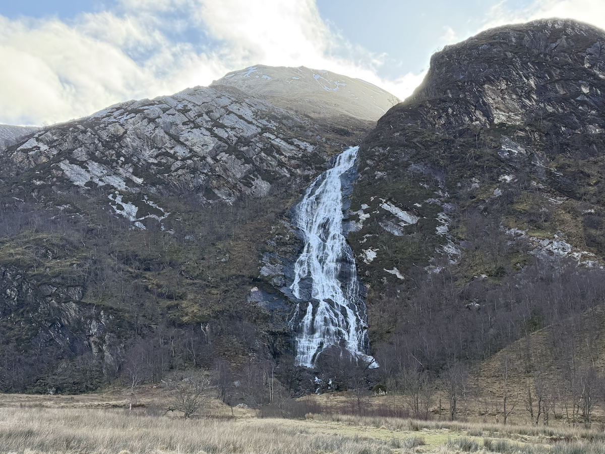
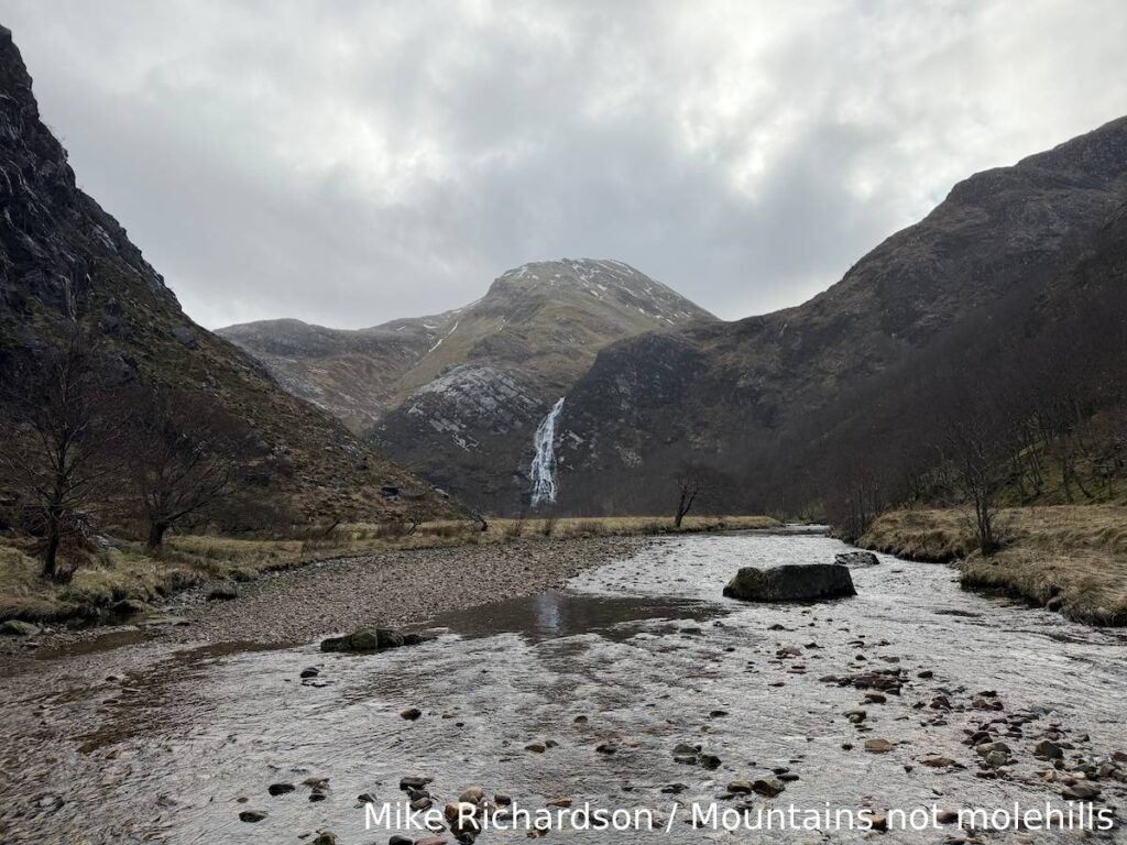
Steall Falls (An Steall Bàn) in one such walk. A 2.5 mile there-and-back route in the dramatic landscape of Fort William in the Scottish Highlands — and one you will be glad to have added to your itinerary. At 120 metres (390 feet) Steall Falls is Scotlands second highest waterfall.
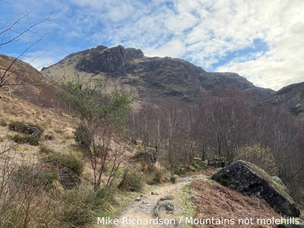
The walk winds through the stunning Nevis Gorge, with some narrow steep and rocky sections but in general the walk is family and dog-friendly. This is a thoroughly enjoyable walk, combining dramatic scenery, a bit of history and enough adventure to feel like an escape into the wild — without committing to a full mountain day.

🌤️ Know Before You Go 🌤️
- Car Park: Upper Falls Car Park
- What3Words: ///router.crumb.turkey
- Public Transport: Closest train station is Fort Willian with local bus services running to the Ben Nevis visitor centre but it is still a bit of a walk from there
- Elevation Gain: 220 metres
- Terrain: Well defined paths, steep, rocky and uneven. Large steps and loose scree.
- Public Toilets: No – Upper Falls car park is free to park but very small with no facilities.
- Family Friendly: Yes – buy not ideal for young kids or pushchairs due to uneven and rocky terrain in places.
- Dog Friendly: Yes – depending on their ability – dogs should always be kept on a lead as their is livestock in the area.
- Munros: (0)
- Scramble Grade: None
- Met Office Mountain Forecasts
- Mountain Weather Information Service (MWIS)
- Scottish Avalanche Information Service (SAIS)
🥾 Essential Kit 🥾
- Good quality, well fitting walking boots/shoes
- 20-30L rucksack
- Gloves, hat, neck gaitor/snood
- Map, compass, and head torch (spare batteries)
- Emergency First Aid Kit (foil blanket, whistle, plasters)
- Additional layers of clothing
- Waterproof jacket and trousers
- At least 2 litres of water
- Hiking poles (optional)
❄️ Additional Winter Kit ❄️
- Hiking poles with ice fittings
- Waterproof hat and gloves
- Crampons/Ice Axe
- Dry bags
- Extra food and water
- Sun protection
- Emergency shelter such as a survival or bivi bag
- A more comprehensive First Aid Kit
Steal Falls route description
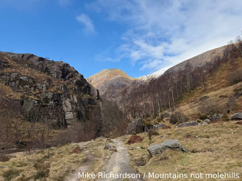
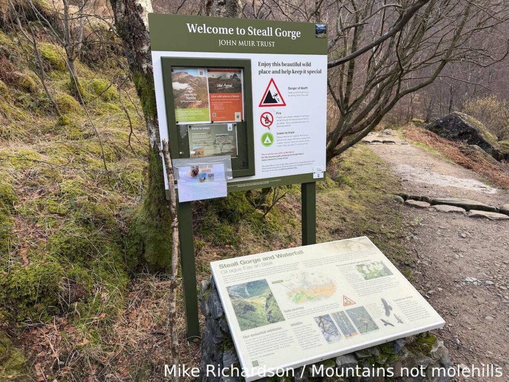
Starting from the Upper Falls car park there is an information board with the entrance to the walk right next to it on the right. You are immediately immersed into beautiful woodland with the river running lower down to your right.
The path is relatively gentle and winds round, but you will need to be prepared to cross a couple of streams using the rocks — as well as some caution. When we visited it was a bright sunny day but we got an early start so there was some ice underfoot which nearly caught us out a couple of times.
As the path continues it will narrow significantly in places before you reach some wooden steps and a boardwalk section. Following this section the woodland opens up. If you look ahead you will be able to see Steall Falls in all of its glory.
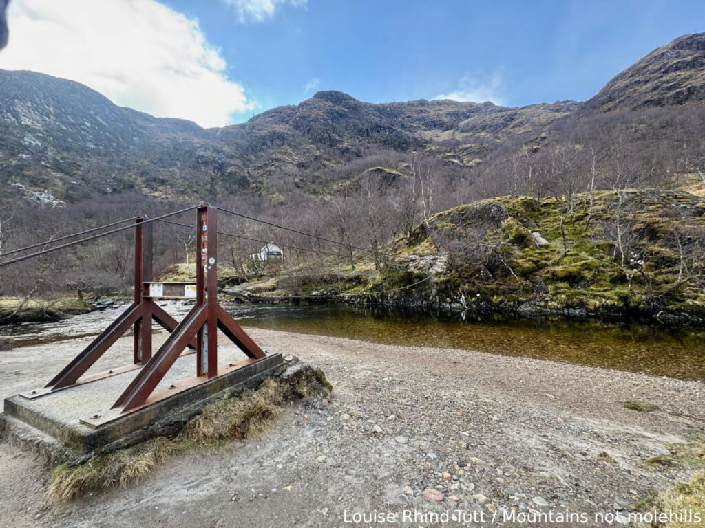
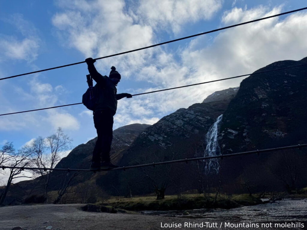
A short walk along and you will reach the steel wire bridge. This is the crossing point to be able to reach the foot of the falls. Although it looks a bit sketchy the hardest part is getting up onto the wire itself. As long as you take your time and are careful with placing your feet the bridge feels strangely sturdy.
Once across the bridge it is only a very short walk to the foot of Steal Falls where you can do some exploring. Once you are ready you simply retrace your steps back across the bridge and along the footpath you came along until you reach the car park again.

Got the OS Map App? Follow the route by clicking the link below.
Where to eat and drink after hiking Steall Falls

If you are anything like us then following the completion of your walk will be the question “where do we go for a pint and some food?” The obvious answer in this case would be the Ben Nevis Inn and Bunkhouse. Situated on your way back to Fort William at the foot on Ben Nevis is the unique 200-year-old converted barn.
Eat, drink and stay all whilst enjoying the stunning views of Glen Nevis, in a friendly relaxed atmosphere, with great food and beer. Serving a lunch menu from 12pm-4pm and an evening menu from 5pm-8:30pm (*times subject to change) there is something for everyone. There is also live music every Thursday evening.
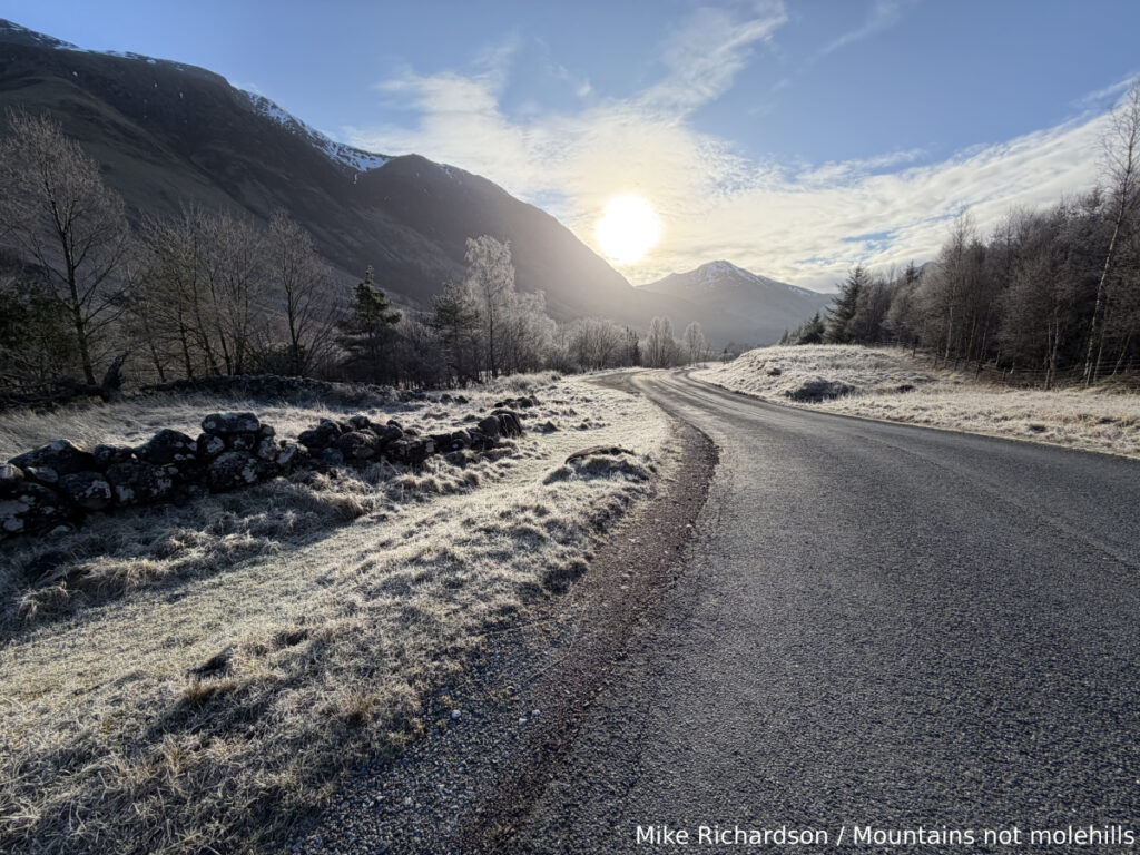
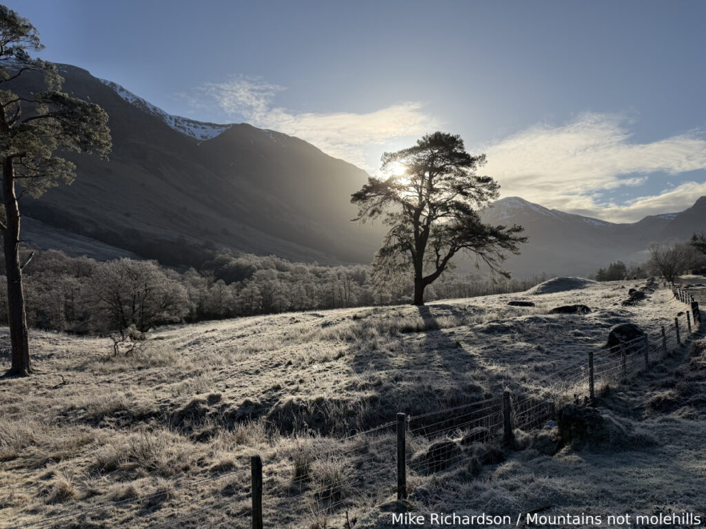
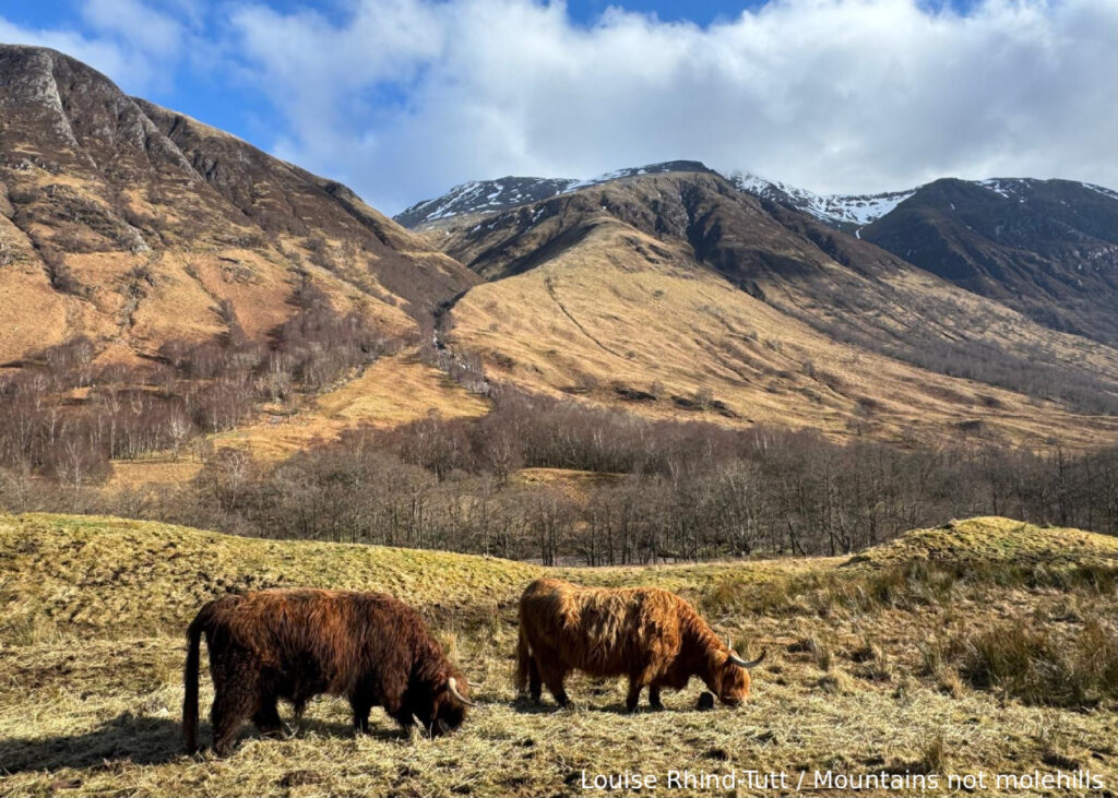
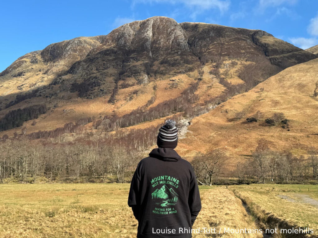
Pics from the peaks: more from Steall Falls