Snowdon (Yr Wyddfa) Pyg Track: 7 Mile There And Back Route
5hrs
Difficult
6.8 miles (11km)
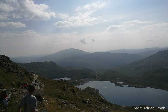
Snowdon (Yr Wyddfa) may be Wales’s highest mountain, but the Pyg Track offers one of the most direct and dramatic routes to its summit. Starting from Pen-y-Pass, this trail wastes no time in gaining height, leading you through rugged mountain scenery with sweeping views over the Glaslyn lakes and the surrounding peaks of Eryri.
The path is rocky and steep in places, but well-marked and hugely rewarding — a true mountain adventure that’s achievable for most fit walkers. Reaching the summit, often through a mix of mist, and wind brings that unbeatable feeling of standing on top of Wales, with views stretching out in every direction.
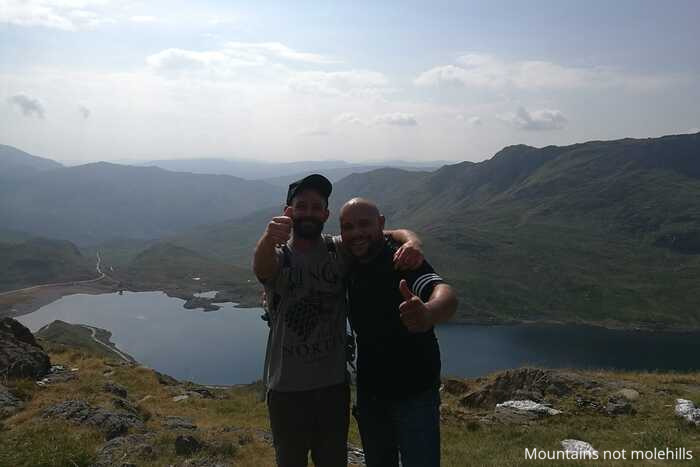
We hiked this route in the summer and it was one of the hottest days of the year which only increased the difficulty level. We had to make sure we took plenty of food and water with us as well as caps and sun cream. We parked at the Nant Peris car park and got a taxi to the start of the walk (approx 15 miles away) as being the height of summer there was a lot of people waiting for the Sherpa’r Wyddfa bus service.

🌤️ Know Before You Go 🌤️
- Car Park: Nant Peris Park and Ride (LL55 4UF)
- What3Words: ///stall.seagull.verbs
- Public Transport: Yes – use the Sherpa’r Wyddfa bus service from the car park
- Elevation Gain: 726m
- Terrain: Uneven, rocky with lose stones, some scrambling may be required
- Public Toilets: Yes at both Nant Peris car park and Pen y Pass car park at the start of the route
- Family/Dog Friendly: Yes but the route is challenging so mainly families with more experienced children. Dogs may require assistance and need to be capable and kept on a lead.
- Scramble Grade: Not graded although section may require you to scramble a little bit
- Met Office Mountain Forecasts
- Mountain Weather Information Service (MWIS)
🥾 Essential Kit 🥾
- Good quality, well fitting walking boots/shoes
- 20-30L rucksack
- Gloves, hat, neck gaitor/snood
- Map, compass, and head torch (spare batteries)
- Emergency First Aid Kit (foil blanket, whistle, plasters)
- Additional layers of clothing
- Waterproof jacket and trousers
- At least 2 litres of water
- Hiking poles (optional)
❄️ Additional Winter Kit ❄️
- Hiking poles with ice fittings
- Waterproof hat and gloves
- Crampons/Ice Axe
- Dry bags
- Extra food and water
- Sun protection
- Emergency shelter such as a survival or bivi bag
- A more comprehensive First Aid Kit
Yr Wyddfa (Snowdon) The Pyg track route description
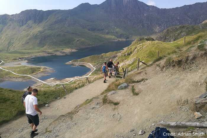
Stage 1 – Pen y Pass car park to Crib Goch split section
As discussed previously there are a number of routes up to the summit of Snowdon — the Pyg Track is the shortest ascent and might well be one of the most scenic. It is worth noting that the Pyg Track is also the starting point for the popular Crib Goch scramble route — you do not want to get these mixed up if you are not an experienced walker so be sure to pay attention to route markings.
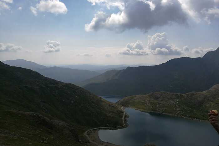
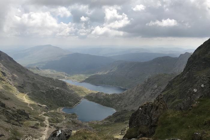
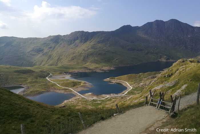
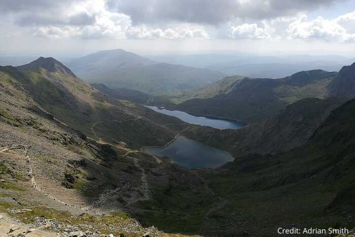
The path leading from the car park is uneven and rugged but is clear enough to follow. It is fairly narrow and with this being a busy route you might find it a bit slow going as people try to get past each other. Soon enough Lake Llyn Llydaw will come into view –it is also at this point that the path splits and there is a fork off to the right which will take you up to Crib Goch.
Stage 2 – Meeting the Miners Track
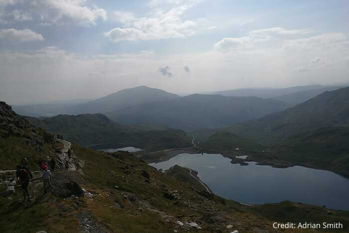
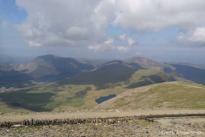
The second stage of the hike is less steep than the initial ascent. The path takes you past the lakes and offers some great views. As the path continues to climb it eventually merges with the Miners’ Track – this path comes from lower down than the Pyg Track. The Miners’ Track is also a popular option for people doing this route on the descent.
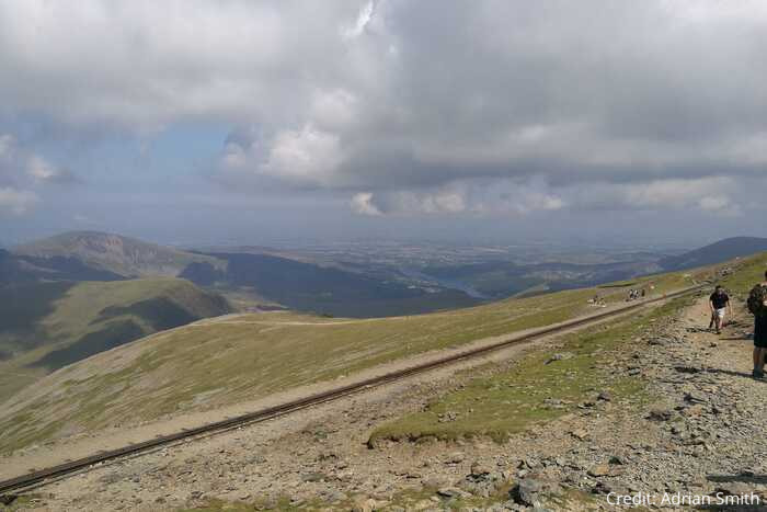
Stage 3 – All roads lead to the summit

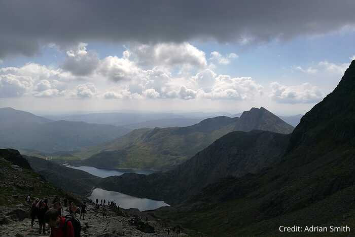
This last section of the hike is the steepest section. The path itself zig zags here and is mainly loose and rocky underfoot so be careful and take your time. As you continue your steep ascent towards the summit the Pyg Track merges with the Llanberis Path. From here it is a short walk to the summit. There is the Snowdon Summit Visitor Centre at the summit where you can purchase snacks and refreshments – again be warned this can be very busy at peak times. To return to the start of the walk opted to descend via the Miners’ Track.
Where to eat and drink after hiking Snowdon
Upon returning to Pen y Pass car park you will be glad to know there is a licensed cafe where you can purchase refreshments. A perfect opportunity to take in the views and have a good chat about the days hike.

⚠️ Safety Warning – Yr Wyddfa (Snowdon) Pyg Track
The Pyg track leads along the foothills of Crib Goch. The route up Crib Goch and along the ridge is extremely dangerous and should only be attempted by experienced mountain walkers.
Crib Goch is a 500-metre knife-edge ridge with no escape route. Even in ideal weather conditions, Crib Goch is a difficult undertaking. Crib Goch is a serious mountaineering undertaking in wet weather, wind, snow, mist or ice.
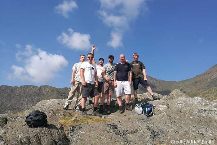
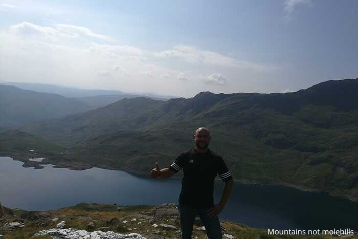
Pics from the peaks: more from Snowdon Pyg Track
%20Pyg%20Track:%207%20Mile%20There%20And%20Back%20Route)