How to choose the right map for you – the experts at Ordnance Survey share their tips
How to choose the right map
Whether you have a definite destination in mind, or a vague idea of somewhere to explore, one sure fire way of ruining a walk outdoors is getting completely lost.
A map is essential and can be great fun to use. But what’s best to pick? One for your phone or a traditional paper map?
Ordnance Survey has both bases covered.

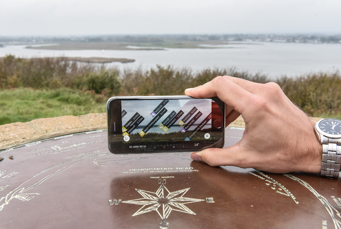
Digital Ordnance Survey Maps
With 90% of us in the UK owning a smart phone, and apps improving all the time, downloading a good mapping app is an obvious step to take.
OS Maps App is Britain’s most popular and has over 3.5 million users. You can download it for free and access standard Ordnance Survey mapping for the entire country immediately, along with hundreds of thousands of ready map routes which have already been shared.
Or even better, you can create and plot your own routes to explore Britain the way you want to.
For less than the price of a fancy coffee a month, you can subscribe and get unlimited use of every one of Britain’s 607 OS Explorer and OS Landranger maps to view, print or download (very useful to do in advance if you’re going somewhere with poor signal).
The premium OS Maps app comes with augmented reality (AR) feature labels, so you can hold your phone in front of you and pan across the landscape to discover the names of the nearest forests, coastlines, hills, mountains out there on the horizon.

And you can visualise routes with 3D fly-throughs before setting off, to get an understanding of the terrain, the best viewpoints or any nearby points of interest you’ll likely discover.
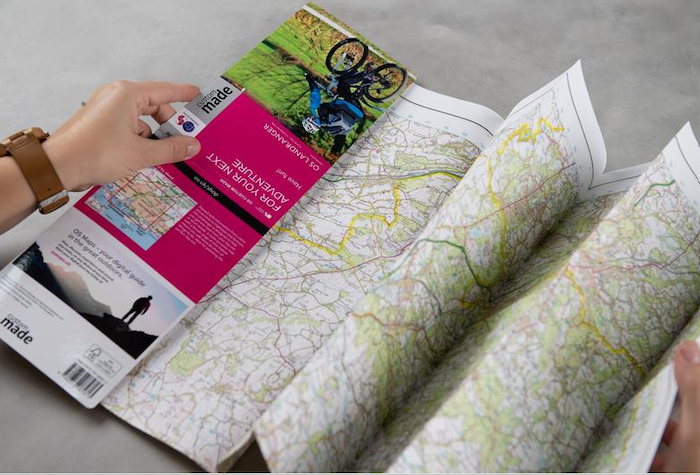
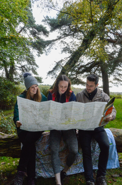
Paper Ordnance Survey Maps
Modern navigation tools like GPS, Sat Nav and mobile apps have pretty much changed the world, but there is still no substitute for paper maps.
These things never run out of WiFi or satellite signal and have saved many a hiker’s life on multiple occasions. Everything you need to understand about the landscape around you, the mountains, the forests, the lakes and rivers, all folds down into something you can fit into your rucksack.
There are two classic paper map options to pick from.
The first is the orange OS Explorer maps, which are 1 to 25,000 in scale. This means that for every four centimetres on the map, you have kilometre on the ground in real life.
They’re perfect for walking, general exploring, going out running, some kinds of kayaking and cycling. These are the paper maps with the greatest level of detail.
The alternative is the pink OS Landranger maps. These are 1 to 50,000 in scale, which means that for every two centimetres on the map, you have a kilometre in real life.
These are ideal when you are going to be covering more ground, so if you’re driving or doing something like road cycling where you’ll be travelling more distance in a shorter space of time. They are ideal if you are heading out on a National Trail such as the Offa’s Dyke Path or the South Downs Way.
One drawback from choosing paper maps is if your route and destination crosses from one map into another (a common issue when you consider there are 403 OS Explorer maps covering the entirety of Britain).
Say you are planning on heading out to the Lake District. One expensive option would be to buy all four OS Explorer maps that cover the Lake District area.
A smarter way of doing it would be to create your own single custom-made OS Map. A custom-made map lets you place your route bang in the centre of it, so you don’t have to fuss between different maps while out enjoying the countryside.
What about cities? If you are planning an urban route then a street map can work well, although many show little detail if you are crossing green spaces.
For your own safety, don’t try to use larger scale maps designed for driving, as these do not show enough off-road features. You will find the same lack of detail with many online maps using Google Maps data, as few footpaths are shown.
Best of both worlds
When you’re out and about, a GPS device or the OS Maps app are great for showing your exact location with minimum faff, leaving you free to enjoy your walk.
But nothing beats the security of having a paper map, which will get you out of trouble if you drop your phone or run out of battery high up a hillside.
Make sure you have one folded up neatly in your pocket and you’ll be truly ready to go.
Find out more about Ordnance Survey maps here